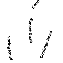
19 SPRING RD
Owner Information
JENKINS, KATHERINE S
19 SPRING RD.
NAHANT, MA 01908


Property Details
19 SPRING RD is classified as a Single Family Residential (Old style).
The primary structure on this property was built in 1920. There are 2,305ft2 of built area within this property. There is 2,305ft2 of residential/living space within this property. This property is listed as having 8 rooms.
19 SPRING RD is valued at $646,600. The land is valued at $362,300 and the structures are valued at $284,300.
This property is in Zone B1. Confirm with local Zoning Board authorities to ensure there are no overlays or other easements on this property.
The most recent deed for 19 SPRING RD is recorded at the local registrar in Book 22437, Page 47. 19 SPRING RD was last sold on Thursday, February 26, 2004 for $420,000.
Assessment data from fiscal year 2022.
Flood Data
This property is completely within the AE Zone (within floodplain).
The base flood elevation for this flood zone is 13 feet.
This information is sourced from the FEMA National Flood Hazard Layer. See our full disclamer.
Broadband Internet Providers
| Provider | Type | Bandwidth (mbps) | |
|---|---|---|---|
| Verizon New England Inc. | Fiber | 940 | 880 |
| Comcast | Cable | 1000 | 35 |
| GCI Communication Corp. | Satellite | 0 | 0 |
| HughesNet | Satellite | 25 | 3 |
| VSAT Systems, LLC. | Satellite | 2 | 1 |
| Verizon New England Inc. | DSL | 5 | 0 |
| Viasat Inc | Satellite | 100 | 3 |
Broadband service provider data from December 2020.
Adjacent Properties
- 0 SPRING RD
Vacant, Tax Title/Treasurer owned by TOWN OF NAHANT-INHABITANTS - 23 SPRING RD
Single Family Residential owned by CARR, MICHAEL B & CARR, SHAWN F; TRUSTEES - 21 SPRING RD
Auto Repair Facilities owned by BARILE, FRANCIS J TRUSTEE - 0 NAHANT RD
Improved, Tax Title/Treasurer owned by TOWN OF NAHANT LOWLAND PLYGRND& PUMP ST